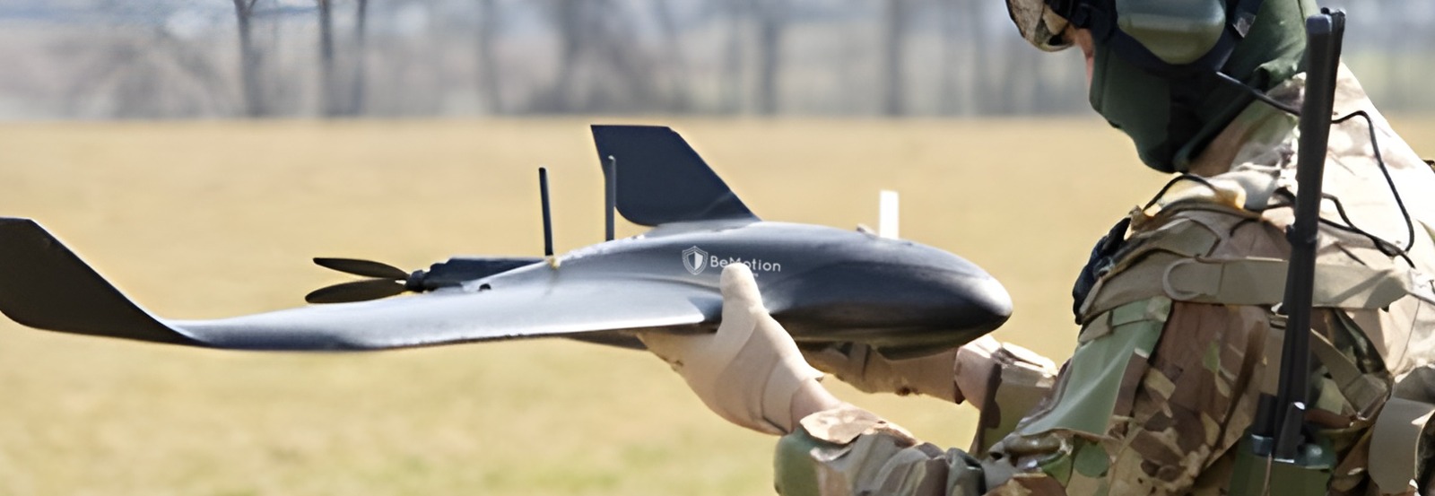

MODEL: VORTEX VISION
The BMS Vortex Vision is a state-of-the-art fixed-wing drone designed to provide exceptional aerial intelligence and data collection capabilities. This cutting-edge unmanned aerial vehicle (UAV) has advanced imaging technology, offering unparalleled precision and reliability for various applications.
Whether it's for agricultural monitoring, environmental surveys, infrastructure inspection, or security operations, the Vortex Vision stands out as a versatile and robust solution. As Governments seeks to enhance its technological infrastructure and improve data-driven decision-making processes, the BMS Vortex Vision presents an ideal choice to meet these objectives efficiently and effectively.
General Specifications:
- Model: BMS Vortex Vision
- Type: Fixed-wing drone
- Weight: 1.6 kg (3.5 lbs)
- Wingspan: 116 cm (45.7 in)
- Material: Composite materials for enhanced durability and lightweight performance
Flight Performance:
- Maximum Flight Time: Up to 90 minutes
- Range: Up to 50 km (31 miles) with extended-range options
- Maximum Altitude: 4,500 meters (14,763 ft) above sea level
- Cruising Speed: 40-90 km/h (25-56 mph)
- Wind Resistance: Up to 45 km/h (28 mph)
Imaging and Data Collection:
- Camera: High-resolution RGB camera with 42 MP sensor
- Thermal Imaging: Optional thermal camera for heat signature detection
- Multi-spectral Imaging: Optional multi-spectral camera for vegetation and crop health analysis
- Gimbal: Integrated 3-axis gimbal for stable and clear imaging
Navigation and Control:
- Autopilot System: Advanced autopilot with GNSS (GPS/GLONASS) for precise navigation
- Ground Control Station: User-friendly interface with real-time data streaming and mission planning
- Flight Modes: Fully autonomous, semi-autonomous, and manual control options
Communication:
- Data Link: Encrypted communication link for secure data transmission
- Control Range: Up to 20 km (12.4 miles) with line-of-sight
Power System:
- Battery: High-capacity lithium-polymer battery
- Charging Time: Approximately 60-90 minutes
- Battery Life: Designed for extended missions with swappable battery options
Safety and Compliance:
- Obstacle Detection: Equipped with front-facing obstacle detection sensors
- Failsafe Mechanisms: Automatic return-to-home (RTH), low battery warning, and emergency landing features
- Regulatory Compliance: Meets international UAV safety and operational standards
Software and Data Management:
- Mission Planning Software: Intuitive software for planning, monitoring, and analyzing missions
- Data Processing: Compatible with leading GIS and photogrammetry software for post-processing
- Cloud Integration: Secure cloud storage options for data management and sharing
Applications:
- Agriculture: Crop health monitoring, field mapping, and precision agriculture
- Environment: Wildlife monitoring, habitat analysis, and environmental surveys
- Infrastructure: Inspection of power lines, pipelines, and construction sites
- Security: Surveillance, search and rescue operations, and border patrol