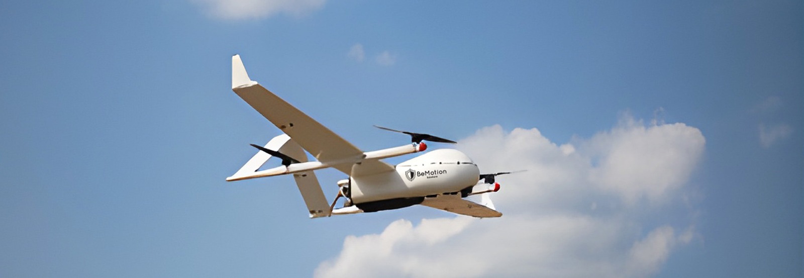
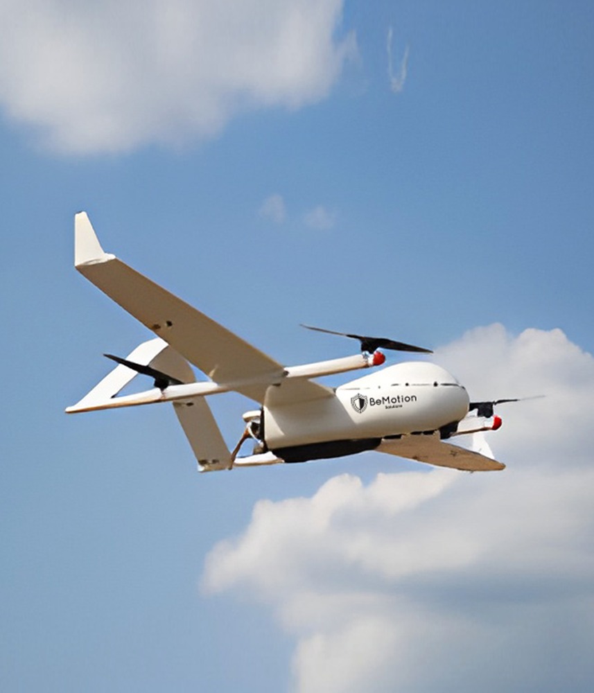
UAV CW-28
The BMS UAV CW- 28 represents a cutting-edge vertical take-off and landing (VTOL) unmanned aerial vehicle designed to deliver exceptional performance and versatility for various applications. This advanced UAV combines the benefits of fixed-wing and multi-rotor designs, offering the ability to perform long-endurance missions with precise vertical take-off and landing capabilities. The CW-100 is an ideal solution for Kazakhstan's evolving drone program, aiming to enhance operational efficiency in sectors such as agriculture, environmental monitoring, infrastructure inspection, and security operations. With its robust design and sophisticated technology, the CW-100 is a reliable and efficient choice for the Kazakhstan.
General Specifications:
- Model: BMS UAV CW- 28
- Type: VTOL fixed-wing drone
- Weight: 14 kg (30.8 lbs)
- Wingspan: 2.3 meters (7.5 ft)
- Material: High-strength composite materials for durability and lightweight performance
Flight Performance:
- Maximum Flight Time: Up to 8 hours (depending on payload and conditions)
- Range: Up to 200 km (124 miles) with extended-range capabilities
- Maximum Altitude: 6,000 meters (19,685 ft) above sea level
- Cruising Speed: 90-120 km/h (56-75 mph)
- Wind Resistance: Up to 60 km/h (37 mph)
Imaging and Data Collection:
- Camera: High-resolution EO/IR camera for day and night operations
- Payload Capacity: Up to 5 kg (11 lbs) for various sensors and equipment
- Multi-spectral Imaging: Optional multi-spectral camera for agricultural and environmental analysis
- Gimbal: Stabilized gimbal for clear and stable imaging
Navigation and Control:
- Autopilot System: Advanced autopilot with GNSS (GPS/GLONASS/BeiDou) for precise navigation
- Ground Control Station: User-friendly interface with real-time data streaming and mission planning
- Flight Modes: Fully autonomous, semi-autonomous, and manual control options
Communication:
- Data Link: Encrypted communication link for secure data transmission
- Control Range: Up to 50 km (31 miles) with line-of-sight
Power System:
- Battery: High-capacity lithium-ion battery
- Charging Time: Approximately 120-150 minutes
- Battery Life: Designed for extended missions with swappable battery options
- Hybrid Power Option: Optional hybrid power system for extended endurance
Safety and Compliance:
- Obstacle Detection: Equipped with multi-directional obstacle detection sensors
- Failsafe Mechanisms: Automatic return-to-home (RTH), low battery warning, and emergency landing features
- Regulatory Compliance: Meets international UAV safety and operational standards
Software and Data Management:
- Mission Planning Software: Intuitive software for planning, monitoring, and analyzing missions
- Data Processing: Compatible with leading GIS and photogrammetry software for post-processing
- Cloud Integration: Secure cloud storage options for data management and sharing
Applications:
- Agriculture: Precision agriculture, crop health monitoring, and field mapping
- Environment: Wildlife monitoring, environmental surveys, and habitat analysis
- Infrastructure: Inspection of power lines, pipelines, and construction sites
- Security: Surveillance, search and rescue operations, and border patrol